Showing posts with label geocaching. Show all posts

Wednesday, January 4, 2012

Lost Grove Lake

 The other day I was looking for a terracache or two to do and this one peaked my interest.  It's called Lost Grove Lake.  By reading the description this is a lake that is currently being built.  I've been to many man made lake, so seeing how one was being built, well I really wanted to see it.

As of right now you can see where they have cut down trees and "sunk" them to the bottom.  And how they are putting rock all the way around the edges.  It was pretty cool to see.  I'll take the discription of the cache here to kind of tell more about it.

" Lost Grove Lake is a man-made lake in the development stage. Lost Grove Lake in rural Scott County could be described as a future top recreational attraction in the Quad-Cities. The 350-acre fishing lake stretches across 1,200 acres of state land that is located eight miles north of Davenport and four miles west of Princeton.

It is estimated the dam construction will take up to two years to complete and it will be another two years for the lake to fill with water. Design of the dam has delayed the lake project. The new design will take into consideration revised federal rules which changed since the first was completed 19 years ago. The area around the future lake has been seeded with native grass seedlings. When finished, there will be wild flowers and five species of mixed native grasslands to attract the bird population. A three to four mile trail will wind around the area."


The area is big enough I didn't explore the whole thing, and there was a few hunters out in the area but I can't wait to see how this project comes along.   Here's a few pictures of the area.


 This is just a general photo of the area.  I wish I could of gotten up much higher to get a better view and photo.


Here's the other side of the road and how it's coming along.  You can see the rock they are putting in along the edges of the lake, and the different depths they are making it.

 I must say a huge thanks for WUGOII for placing a terracache here.  It was pretty cool to see this before it's filled up and put into public use.

Tape worm \m/

Sunday, July 31, 2011

Apocalypse Now


I saw this terracache get published and knowing the area, I thought, I know just where that would be, and couldn't help myself from laughing.  It was a very evil laugh, knowing just what the area does, and seeing who owned the cache I knew it would be a good one.


The area the cache is in is called the Coralville Res. It's a man-made "lake" that depth is controlled by the Army Corps of Engineers.  Right here is looking down the old highway that was taken out of use many many years ago after the Interstate was build nearby and the Res was created.  Some of that old highway is still there.  Many times during the year parts of it are underwater.  I had done a geocache near hear a while back, but at that time the old highway was underwater and I had to take a very long route cause you couldn't go straight to the cache you first had to walk about a quarter mile or so back deeper into the woods to find dry land to cross.

But this time I was on an epic journey and got to see and follow the old highway, I have seen for years from driving by on the interstate.  I had always wanted to go down when the water levels where down, and check it out, but just never got around to it.


These where just some of the sites in the area I got to look at as I walked down the old highway.  This whole area is really neat to walk along and see.  I even noticed across on the other side of the bank a couple of people fishing.

I kept moving on watching out for those helicopters, and snipers off in the trees hearing some rounds being fired off.  I had to make my journey a quick one and try to sneak in and out unnoticed or face an untimely death.


I was moving along and getting closer and closer to the cache when all of a sudden my path was blocked.  Which left me with the decision of making a swim for it, or trying to find yet another way around to the cache location.
I'm not the smartest one in the bunch but I've got this problem when it comes to terrain.  Getting wet, so what, sore legs from steep hills, child's play,  hanging on to a tree over the edge of a bluff, fun.  But it was kind of early in the year yet, and that water was going to be cold.  I debated swimming across, or looking for another route around.  Normally, I would have just dropped my gear and went the wet route, but I spotted what looked to be a much longer way around but doing so without having to swim.

I found one of the unlucky ones that didn't survive the journey and was picked off.  I had been spotted and was on the run but made it threw the heavy fire fight with very minor wounds.

I even noticed some spent rounds when I got to a spot I could get out of sight.


I finally made it around and even went as far to see the other side of where the water stopped me dead in my tracks.

After a short search, I hit pay dirt!!!  Which once I found it, all I could do was laugh again.  The perfect spot for a Terracache.  I signed my name to the log, and recorded my journey in the log.  I grabbed the cc code and then was on my way back to the car.


Now just for the record, there really is no firefight to avoid, it all just seemed fitting given the title of the cache.  Also I've done a few tricks in the blog and was very selective in the photos as not to give away a few surprises.  But they are quite funny.  the only way you'll know is, by making the journey yourself.  And yes, it's worth it.  A well done cache!!

The SS Minnow

The SS Minnow


After talking all summer long about going and hunting this Terra-cache called the S.S. Minnow, we finally where able to get the plans made for the hunt.

The S.S. Minnow was a cache placed by mmdals over two years ago and had only been found twice since it was placed. It was hidden on an island out in the Mississippi near the town of Cassville, WI. Wugo II was able to put together a boat trip and 8nut's provided the boat and some great driving as well. We where joined by leaderdog as well. The four of us met up at a boat ramp in Cassville. 8nut's had his boat in the water all ready to go when I got there.

It was quite a journey to the island. With the floods we have over the summer we didn't even know if the boat (the minnow) would still be there. It was just over 4 and a half miles from the boat ramp to the cache. It had rained a bit on my drive up to Cassville but had stopped by the time I got there. The weather other than the rain was perfect.

The trip along the Mississippi in the boat was a lot of fun. We got to see some barge's and one full of coal that was on the bank being unloaded by a crane. There's a car ferry there as well that will transport your vehicle across to Iowa if you didn't want to make the drive around. I'm sure this cuts a lot of travel time down. But I got to see a car on board the ferry.

As we neared the island I could tell all of us where getting anxious to see if we could find this one. We drug the boat ashore about a quarter mile away from our destination. From there we found some nice ground to hike in the rest of the way in. As we walked along very shortly after pulling the boat in I heard Wugo say there it is. I could feel the excitement growing but still couldn't see it.

Sure enough we got there and there she was. This was just amazing to find. I can't image how someone found this abonaded boat on the island. It was about ten feet long and about 4 foot deep. currently with the water level being down the boat was on land but as some of the picture's on the cache page indicate it does float when the water level comes up.

The wooded boat had about two inches of dirt and plant's growing in it. The hull of the boat was in pretty bad shape and a lot of the wood was roting away. We spent some time there at the "Minnow" talking about this and that and enjoying the day. This was quite a fun trip. I was glad to share this with the other's. It was great to have some great company along the journey. But as all things do this cache hunt was at it's end.

We all left the "Minnow" and headed back to our boat. We got rained on just a little on our way back but really it could have poured and I don't think anyone would have cared. We pasted a couple of other boats on the river on our way towards the dock where just a couple of hours earlier our journey had started. We spotted a couple of Bald Eagles flying over the river as well.


Once we docked we sat around for a little while and visited a bit about our other caching adventure's. This will be yet another one that will be talked about for quite some time to come.

It was great to meet the famous 8nut's who I seen the name but had never meet in person. And as always is was great to join Wugo and leaderdog for a cache hunt.

Now that the S.S. Minnow has been found I don't know what will be the next great adventure. I guess I need to hit the web-site's to see what else it out there waiting for us.

Sunday, July 10, 2011

Under Every Helpful Smile.....

I was on my way back home after doing a few caches up in southern Minnesota, and I had this cache mark as I could do a little backroad driving and could get to it without going to far out of my route back home.  I had an ok day caching, but too much time spent driving in the car.  This Terracache is called Under Every Helpful Smile.....  I had looked at the distance and elevation and thought this one won't be bad, should be a nice way to finish off the day and it would give me a small break from the road.  The one thing I didn't take into account was the owner.  I should have known better that it wouldn't be a walk in the park, but wasn't expecting what I ran into.  It was quite a workout.  Plus this was a neat idea.  This cache was made at an event that the attendees got to log, but those that missed it would get the pleasure of vising it out in the field.

As I was trying to find my way on the back roads of Northern Iowa, I was completely turned around and was starting to debate if I should tried this without a full tank of gas.  This was an area where homes are few and far apart.  When I saw this place, thoughts were rolling threw my head this is the perfect way to start a horror movie. I passed this little "store" thinking, yup if the car breaks down that's where I'll have to walk to, looking for help, since my cell phone had no signal in this area.


As I took the twisty and winding roads I finally made it down to the parking area.  Which nobody was around.  But I'm in the middle of no where.  I looked at the GPS and saw it was only .30 of a mile away.  This was when I thought, yup piece of cake.  Please remember I'm still having problems with my neck and shoulder since I had major surgery done on my neck about 6 months ago.   So off I head into the woods looking for a trail of some sort.


It became quite clear after the first  tenth of a mile, this was going to be very ruff.  You are walking on the side of the slope upward the whole way there, and all I could find at times, where a few small broken animal trails.  It was bushwack city the whole way there but you had to be careful cause there was slippery grass under the tall foliage.  At times you where reaching for something to grab onto to keep going which most of time, I grabbed some plant with thorns or got a handful of neddles.  As I kept going in deeper it was starting to get dark out and I really didn't want to be here in the dark, so I was trying to be quick, but the bluffs at the top of the slope were really neat to see.


I finally reached ground zero, and thought just by looking, it right there in "that thing".  Nope.  It was going to take some climbing around these big boulders and a little searching to find it.  This is what I looked like with the cache in hand.


I took note of the cc code by taking a photo of it twice, and writing it on my hand.  I had left my pack in the car since the distance wasn't far, but wasn't expecting having to deal with such thick foliage.  I swear I was waiting and listening for banjo music to start playing.  This area is never visited.  But again I had no time to waste, as I wanted to get back to the car before it really got dark out.

I have to say this was the roughest cache I had hunted in a very long time.  Of course there will be better times of the year to hunt this one down, but I'm glad after it's all said and done to have done it right in the middle of summer.  It was also a good reminder to take my pack even if the distance and elevation isn't very much as you just don't know what kind of terrain your really going to run into.

Wednesday, June 29, 2011

Galena Bike Trail

I took on a few TC along the Galena Bike trail a week or so ago.  This was a very nice trail to take a ride on, for one, it's all flat. lol   But near the start of it was a small spring.  That I thought was really neat.


This spring looked like just water was bubbling up from the center.  As I was over here checking it out, another bike rider rode over to me and asked it there was any side trails.  Which I had no idea as this was my first time on the trail.


After reading about the spring and watching it for a bit, it was time to head on down the trail to look for a couple of caches.  This was a nice trail.  Most of it was pea gravel, which is nice to ride on.  The caches I was after where about 2 miles out, and I think 2 miles was the end of the trail.

My first stop was at a cache called Cabin Fever.  I don't know how woodsie found this but it was pretty interesting to see.  If you read my log on the cache, most of it was just joking around saying as I got close I saw this neon sign saying "Eat at Woodsies".  This rusted out "cabin" is barely standing, but was very interesting to check out.  It was just a one room cabin with what looked some sort of fireplace furnace, in the middle of it.


The cabin from a distance.

Inside the cabin.

After checking it out, I didn't stick around long as the sketters where eating me alive.  The rest of the trip, I was wondering who build this, and why.  Why would it be so small?  Questions that I don't think I'll ever get answered.

Then it was on to the next Terracaching, End of the line.  Again getting back on the bike trail, was quite a relief as I was able to out run the sketters, and biting flys.  This one was located near the end of the trail, which is where I ran into some trouble.  I had to do a second dose of bug spray cause the first coat was just like adding flavoring to me.  Which you know what I mean if you've ever had that burning feeling from using too much bug spray.  This area was neat as there was a picnic table, and a bench where you could watch trains go by on the tracks.  There is also a geocache near the TC as well, but I never was able to lay eyes on it, but the forest floor at spots was armpit deep, and I tripped over a few logs on the ground you couldn't see.  I found an old "cellar" type object here too.


When I finally found the Terracache, it was a sight for sore eyes.  A nicely stocked  ammo can.  I think all I got in the log book was my name, and the work sketters.  They where so bad over here, I didn't stick around long.  But I had a great time hunting these two, and again just wonder how he found that cabin.

Happy and safe caching!!!

Tape worm

Friday, June 24, 2011

4.5 Terrain Challenge

It's been a very long time since I've made a post and figured it was about time to start getting caught up.  I started working on this series of caches over in Boone, Ia and just south of there.  Since there are 9 caches in this series, and I have yet to finish it up, I'll just talk about 3 of them located in McHose Park.

This park is very deceiving but has some really neat hidden away things.  At first I thought this is going to be a piece of cake, but remember I had spinal surgery and the ravines where really testing me and I walked away that day in a lot of pain.  But I found this trail that lead near the caches so then I just had to climb down and up the ravines.  This is a pic of me standing down in the ravine.  You don't get the full feel of the 100 feet climb out of them though.


Then as I was going along I realized this trail used to be a old road years and year ago and ran into a spot where an upside down bridge was.  It was too early in the morning to get my feet wet and hike around with wet boots all day so I looked for another way to cross.


Also here was some neat river banks I saw that I thought really were cool.  Plus there is a disc golf  course and you have to toss the disc across the stream.

As I was walking along this trail I found a really odd thing.  It's hard to explain so I thought I would just show the photo of it.
I took a few to relax while I was here and examine it some.  After a bit of a break I kept going down the trail and I finally found a bridge that crossed the stream.  But on the way there I noticed across the stream a small tunnel.  So when I did get over to that area, I had to climb down and check it out.


After checking this stuff out I went and found the last of this series in this park.  I also grabbed a couple of other caches while I was in the park, but I just thought this whole hidden area that isn't visited by very many held some really neat and historic things.  I really just thought the best way to explain was to use photos I took.  If your in the are and have some time check these out.  I really had a good time in this park.  There are a few other caches in this park I'd like to check out as well.  Again, this was just the first half of this series.  I think I found 6 of them that day, before I just had to bail due to my neck.  I've been busting my butt trying to build my neck and shoulder back up to par.  My neck is doing great, but having a lot of shoulder problems.

Happy and safe caching!!!

Tape worm

Monday, April 4, 2011

Hanover Bluffs

This past weekend I went on a little road trip to go around and look for a few terracaches and a few geocaches.  I 'm not sure how I got as far into Illinois as I did, but sometimes you just get going and notice another cache on the map that looks interesting.  I really enjoyed this terracache called Hanover Bluffs.  Also in the are is a geocache called Hanover Bluffs (GC).  In the Hanover Bluffs area there was a geo pretty close to the parking area and the terracache was pretty far into the area.

I got a kick out of this sign as I started down the trail.


At this point in time I wasn't sure where you could swim.  But as I got deeper into the area I did find a lake that I think they where talking about.  I also found this little spot and decided to do a little skinny dipping.  J/K
As I kept following the path, which seemed just to go downhill the whole time.  I finally made it to a spot where I had to do some climbing to get to ground zero.  Normally I would play billy goat but   I had a head cold and every time I went up 10 feet up the hill I had to stop and catch my breath.  Once I made it to ground zero, There was a lot of places to look.  I spend the next 20 minutes looking for the cache but wasn't able to find the cache.  Finally I decided to sit down for a bit and just relax.  As I was sitting there, I looked over and noticed something, and sure enough it was the cache.  I looked threw the logbook for a bit, and then signed it.  I rehid the cache and started back down the the trail.  I wanted to explore the area a bit more, and was walking along on the edge of the trail and almost tripped over a benchmark.

After that I walked around on the trails a bit and found where they where talking about no swimming.  Finally it was time to head back to the car.  Now since I went down hill the entire time on the way in, sure enough it was up hill the whole way out.  But I really enjoyed this hunt.  I just wish I wouldn't of had a head cold.

Monday, February 21, 2011

Crusing Down the River

At the end of last summer I had been eyeing this cache that hadn't been found yet.  It was a couple of weeks old but the trick was it was on a small island in the middle of the river.  This area is a popular spot where you can rent a canoe or tubes and float down the river.  I was thinking on how I could get to it but I was missing one think.  If I parked to float down the river I would of had about a 15 mile hike to get back to the car from the pull out point.  I didn't have another person to park their car at the pull out point so we would have a ride back to the start of it all.


So I got to looking at the maps and the boundary's of the state park and it looked like I could get to it by following the edge of the river.  One small problem.  The terrain next to the river had very steep slopes and a lot of bluffs.  So I did what any other stupid person would do.  Tackle the terrain for 2 miles to get as close to the cache as I could.


As I started off on the trail, I ran into some rock climbers and some repellers.  It was a perfect day to be out in the woods, and really cool to stop and watch some of these people.


 As I moved a lot down the trail you could tell few people had traveled this far in, but yet I ran into a few more groups of climbers.

This was about the end of the trail and the terrain got very ruff.  I started to have to find animal trail to get to the top of some of the bluffs just to have to climb right back down them again.  Still this was a amazing park and I think few see these bluffs.  I finally got luckily and found a broken animal trail with a lot less ups and downs.  Which about a half mile of that I finally had to climb down the last bluff to a low spot and hike back out to the river.  As I got as close as I could before I had to cross the water, I found a fallen log next to a small beach like area.  I decided to take a break for a bit there.


As I was sittng there I could here people coming down the river and of course they spotted me.  This is when my trip got kind of interesting.  They had to stop right there and they came over to me.  One lady sat down on my log I was sitting on and started jabbering away.  She was drunk.  Then the questions came.  What are you doing out here? Are you homeless?  Are you some sort of murderer hiding out in the woods.  They just where not buying my hiking story.  Thankfully they didn't stay long and it was time to get wet.  I stripped down to my shorts and just my GPSr and headed for the small "island" in the above picture.  At first it got very deep, then very shallow, then deep again.  As I got near the island I saw another group floating down the river but they weren't interested in me at all.

Once I reached the island all the trees and bushes where a mess and hard to bushwack threw, but I finally was able to wiggle my way to the cache container.  Of course when I found it, I found a little trail that came from the other side of the island that was very easy to pass threw.  I signed the log sheet and then headed back over to where I left my camel-pak and other hiking supplys.  I decided to take another break and started doing some thinking on how I could find a way back that was easier.

This is where I started to devise a plan using the river to make it back.  I finished off the rest of my water in my pack, I didn't realize how warm it was till I ran out of water.  That gave me the idea that I could put my electronics inside of the battler of the bag, to keep them dry.  Once I put them in, I used the straw to blow air into the bladder and fill it up with air.

I then put the pack on my back, and went into the river.  This made a make shift floating device.  I just did a back float and got into some current and let the river do all the work.  Which this worked out very well, I got to see those bluffs I had been climbing up and down on.  I think by this point all the people on the river today were down stream and I had the whole place to myself.  What a great way to finish up the cache hunt.

I noticed by this time it was past the time I told my wife I would call her by.  It took a lot longer to hike out there than I had planned on.  But my cell phone didn't work out here at all.  Thankfully she didn't freak out that I finally called about an hour and a half late.

As I floated down stream I hit some shallow spots that had lots of rocks.  Those spots kind of hurt the legs a bit, but it still was a fun trip.  When I finally made it back to the truck I had traveled 4.67  miles with 976 feet of elevation gain.  Which is a lot of elevation for Iowa.  Two months later the cache owner made another trip down the river and planted two more caches.  Those I can't reach from the park so I'll have to the floating down the river thing.  I'm looking forward to attempting those this up coming summer.

Saturday, February 12, 2011

My Pathtag's


So far I've had two different pathtags made up.  Both of these use my old geocaching handle of Parabola.  The one on the right was the first one I had made which I've just done alot of on-line trading and have dropped a few off in some caches along the way.


The one on the left has a twist to it.  I've worked with a bunch of Terracachers to make this one happen.  I put one tag in a baggie with logging instruction for Parabola.  What I did is had a bunch of tags made, then sent some to terracachers around the world, who dropped them off in random caches.  Using some of the code on the back for the cc code, and a code so I can tell who left the tag, they get to log this cache.  One of these days I'll map out all the cords of the found tags just to see where they all where found.

I've still got some I need to get placed which will be my goal for this spring.  I've had a lot of people e-mailing me, trying to get me to trade for this tag, but I've turned them all down.

Some day I'll have to get a "Tape worm" tag made up.  I've got some good ideas for it and some of the art, just need to put it all together.

Friday, February 4, 2011

Hawkeye Area Council Geocaches

Hawkeye Area Council


2010 was a very busy year for me.  I put out a lot of geocaches for the 100th anniversary of the Boy Scout program.  The whole idea was to introduce scouts to geocaching.  With the way we set it up the majority of the caches were named after merit badges and had the requirements of the badge on the cache page.  There was also a cache named after each rank that a scout could reach which turned out to be a series inside of a series.  You have to find the 11 ranks to get all the information to help you find the H.A.C. -Eagle Scout cache.

In all there was:  3 events
                          6 puzzle caches
                          20 multi-caches
                          71 traditional caches

You can find the bookmark list here.  This list has all of the geocaches and event on it.

We the whole idea was first brought to me by WindChill.  I thought the idea was great and instantly thought of putting one cache out for each year of the scouting program.  There was a few certain caches the would have to be placed like the 12 "cache to eagle caches" and the 5 "treasure of scouting caches" and then a C.I.T.O event which Borky00 hosted.

To open the caches up to try to hit every ones interest I was able to get my hands on a pallet of ammo cans.  This made it so I could put trading items inside the caches for people that like to trade, the containers where large enough so travel bugs could fit in them.  Also with the mix of the types of caches, and some that were drive up caches and hiking caches.  I figured this would open it up to show any scouts just about any combination of hides.

Some of the local cachers did donate some containers/swag/spray paint to the project.  They were WindChill, Welch, DuitTuit.  Also there was some special travel bugs that where put out by the Scout program.  Which they where intented to draw attention to some of the great things about scouting.  Borky00 made some pictures for each one and came up with the idea of attaching keychains to them that would hold those pictures.  They are still floating out there.  Also there was a travel bug that you need to attach to a pinewood derby car that's goal was to reach the location of the big scounting event for the year.  At the moment I can't think of what that event was called though.

But getting back to the caches.  My first task was to try to get permission from a whole lot of parks in the county's that made up the Hawkeye Area Council.   Since I had 7 counties to deal with this ment I had quite alot of people to contact.  I was so relieved to get all of those counties on board without any trouble at all.  Everyone of them thought this was a great way to get people to enjoy their parks and they gave me the green light.

I also had to locate a bunch of Eagle Scout projects to try to hide 12 of the caches by or somehow use the information from the plaques to send a cacher off to where the cache was hidden.  I really found this to be one of the hardest tasks to do.  I have seen tons of project threw the years while out caching but never marked them.  Also once finding one, I had to look and see if there was any caches with 528 feet of it.  If there was I couldn't put a cache at or near the project to keep within the distance guidelines of geocaching.com.  Then I would have to try to make the project a "virtual" waypoint and send the cacher off to a location where I could put a container out.  This took me about 6 months to complete.  These caches had one of the scout law in each of the caches.  When a cacher could tell me what laws were where, they could get a special patch.

The other required project was the 5 "treasures of scouting".  These could go any where though.  I was able to get one place right at the scouting office.  These caches also had cards in them that a cacher could fill out and drop in a box or mail to the office.  Those cards where put in to a monthly drawing for a special geocoin.  WindChill took care of the drawing each month.

As the year went on I found I had to use most of my free time to get these caches place.  At a couple of points I really thought I was going to have to reduce the 100 caches to much less.  But I kept at it and kept at it and finally towards the end of the year I was getting close.  Then I found out I was going to have to have spinal surgery.  At that point I was about 13 caches away.  Since the snow was now hitting the ground it ment I wasn't going to be able to make any more "hiking" caches.  I was really trying to avoid placing many park and grabs.  The whole point was to get people to get out and enjoy the parks and exploring new areas while telling people about the scouting program.  Luckily I still had some decon containers.  I figured if I'm going to make some park and grabs, I wouldn't place a micro container.  I really wanted to stick to making the caches have a few trading items and room for a travel bug.  I did have to convert some of my own caches that I had listed on Terracaching.com.  I really didn't want to do this, but I feel it worked out ok and don't think anyone had a problem with it.

When it came time for my surgery I still had about 6 caches to place.  With the snow on the ground I couldn't do any type of hiking cause I couldn't risk falling on ice.  Luckily I got some help from another cacher.  Dazedandconfused got a container ready and went off to a spot I found that a cache would fit and meet the guidelines.  They got that one placed for me and I was able to finish up with a few more park and grabs.

Once all the caches where placed I almost didn't know what to do with my free time.  This whole project determined where I was going to cache for everyday and I just hadn't had time to venture outside of the areas I was placing caches.  I really think this whole project showed scouts most of the aspect of geocaching.  Which it was very cool they released a geocaching merit badge too.  I still need to get my papers turned in and I'll be a merit badge councilor for the badge.

I think the whole project turned out very well and a lot of people have really enjoyed the whole series.  I also have to give props to IowaAdmin for reviewing all the cache hides.  I'm sure I kept his plate full over the past year.

Thursday, February 3, 2011

Our Dogs

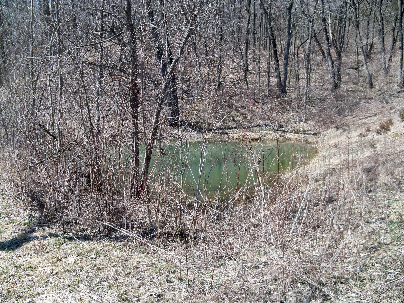
I was just thinking that I do talk about one of our dogs a lot when it comes to geocaching.  He goes with me a lot when I go caching.  His name is Rusty Fox.  He is a pure-bred Shiba Inu. He is about 15 months old.  We got him a little over a year ago and he has really turned into my companion.  He loves to go for walks and really enjoys the outdoors.  He keeps up with me the whole time we are out.  Doesn't matter how far we hike.  When I placed the H.A.C. -Life Scout (GC2H1CT) he tried to keep up and go where ever I went.  Since that cache is on top of a large bolder and you have to climb about 20 feet to reach the top, he tried to climb right up with me.  I had tied his leash to a tree so he would stay down but he still managed to get about half way up before he ran out of leash to go any further.  We somethings think he is a "reindeer".  He can jump really high when he wants to.  Many times he has made it over our fence in our yard.  Here is a photo of Rusty:


Our other dog is a pure-bred pug.  His name is Frank.  Frank is a little over 6 years old.  He's not quite the outdoors type but he does like to go for walks.  He likes walking in town though and not out in the forest.  Pugs drink quite a bit of water and due to there smashed in faces you have to really watch to make sure they do not get over heated.  He's more of the inside dog and just enjoys laying next to you.  He really like people paying attention to him and enjoys laying down next to you.  I don't take him caching very often.  He does like to go for car rides though.  Last fall he got sick and we took him to the vet and found out he is diabetic.  Which ment a big change.  We have to give him special food and make sure he doesn't get into the other dog food or the cat food.  We have to give him shots twice a day.  Here is a photo of Frank:


Again, I talk about Rusty a lot when I talk about caching.  He goes just about every where with me, so I figured I should introduce everyone to him.

Tuesday, February 1, 2011

Shake,Rattle,Roll-Repeat If Necessary


Shake, Rattle,Roll-Repeat If Necessary (GC2B48V)

This was a neat find.  This cache is just down a gravel road and just a few feet from the edge.  Not hard to find at all.  But once you get it, you'll have one small problem.  Getting to the log sheet.  As you can see by the picture there is a padlock on one end, preventing you from removing the end cap.  You'll also notice when you pick it up something is rattling around inside of it.  Sure enough it's the key.

The goal of this one is to get the key from inside of the container so you can unlock the padlock and then you will find a pill bottle inside of it that holds the log sheet.  You must do at the title suggests.  Shake it, roll it, and keep trying till your arms get sore.  The little tube at the bottom is where the key will fall out when you have wiggled the whole container correctly.  This doesn't sound like a hard task, but it took a bit to finally have the key fall out.  I was a bit worried the key would fly out and get lost in the grass, but thankfully it didn't.

I just thought this container was really neat and it was pretty cleaver.  If your in the area check it out!!!

Sunday, January 30, 2011

Abby's Treasure Island


Abby's Treasure Island -GC21D1

I was sitting at home search geocaching.com for a cache to do.  I had noticed that this cache had been found the day before by three guys.  I'm still not up for any kind of ruff terrain after having spinal surgery.  This one I remember is all flat land but a decent walk to get to, and you have to cross the river.  Knowing that it had been pretty cold out, I figured I'd take a shot at it.  I got ready and asked Rusty if he wanted to go along, which his ears perked up and ran right to the door.


Once we got to the parking area it is about 3/4 of a mile as the crow flies to the cache.  So off we headed.  We crossed on the bridge and walked along the river back till we could see the island.  The snow wasn't very deep at all and it made for a nice walk.  At I was looking at the island planning the river crossing I notice at the tops of the trees, there was a bunch of bald eagles.  It was starting to get dark out, so I wasn't able to get a good close picture of them.  I was wondering if they hung out here waiting for people to try to come to their island and fail, so they could pick at their bones.


We found a spot that seemed very solid and tied the rope to a tree.  Then we started the hairy part.  Crossing the river.  We went slow and steady across finally made it to the island.  So far we hadn't seen any signs of the fellows that had been here the day before.  As we made our way to the cache location, we finally saw their footprints.  Once we found the container, we sat and relaxed for a bit on a log.  It was really starting to get dark and I figured we better get back across the river before I had to break out the flashlight.

We followed the same path that we took to the island and where relived once we made it back to solid ground.  As we headed back we left the edge of the river so we could swing by another cache in this area.  Somehow we found some ice again but didn't realize it till I was laying flat on my back.  Ouch!!!! 

This was a fun cache hunt.  I really would like to visit this one during the summer by floating down stream on a tube.